![Habsburg Empire Map [ENG] - Image 2](https://extinguishedcountries.com/wp-content/uploads/2025/09/20250901_094127-scaled.jpg)
![Habsburg Empire Map [ENG] - Image 3](https://extinguishedcountries.com/wp-content/uploads/2025/09/20250901_094143-scaled.jpg)
![Habsburg Empire Map [ENG] - Image 4](https://extinguishedcountries.com/wp-content/uploads/2025/09/20250901_094155-scaled.jpg)
Description
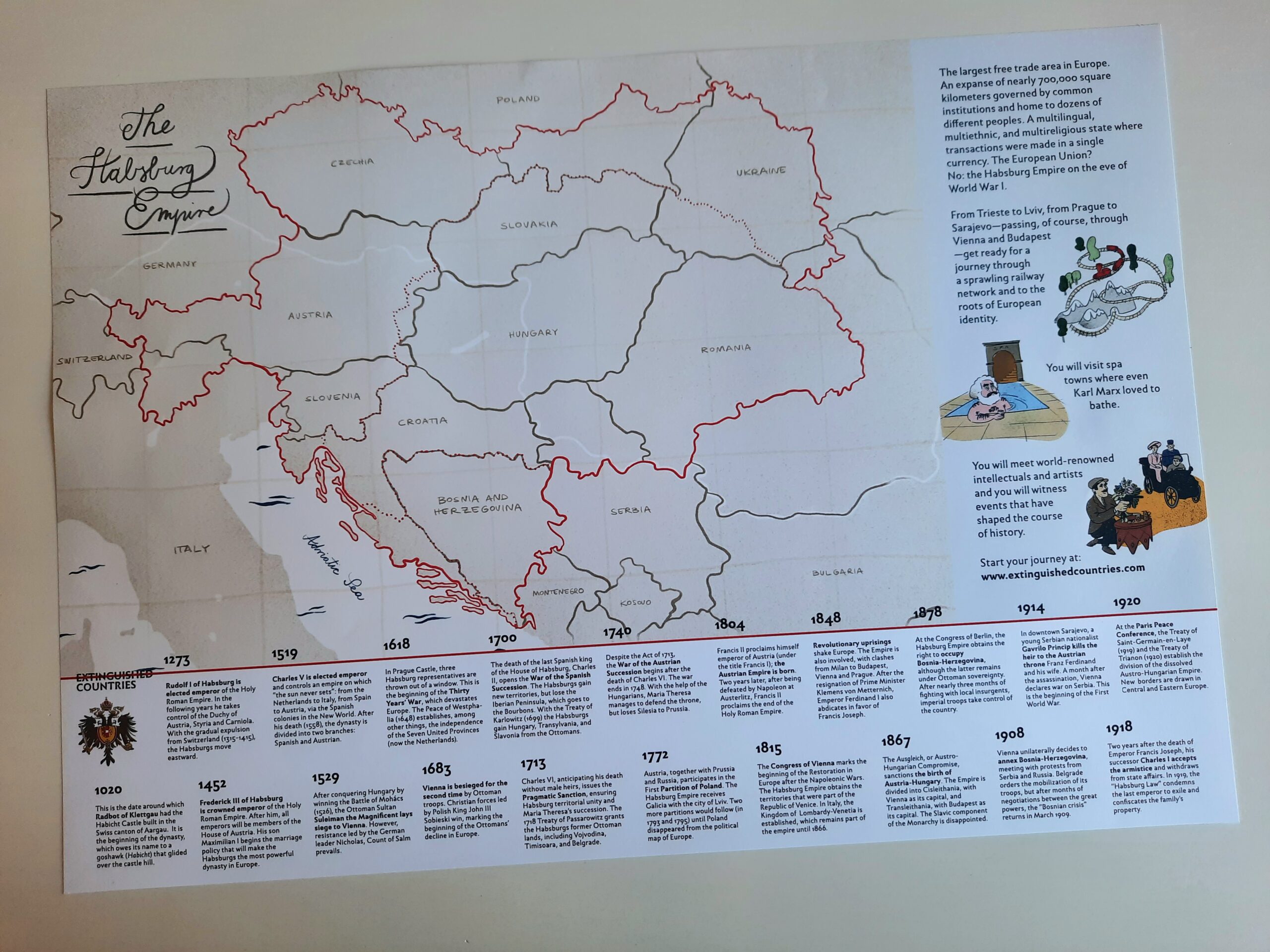
A3 poster map of the Austro-Hungarian Empire in 1914, featuring today’s borders and the historical frontiers (including a dashed red line dividing Cisleithania and Transleithania). Enriched with a timeline of 20 key events in Habsburg history and original illustrations from the book.
Dimensions: 40,8 cm x 28,2 cm